About us
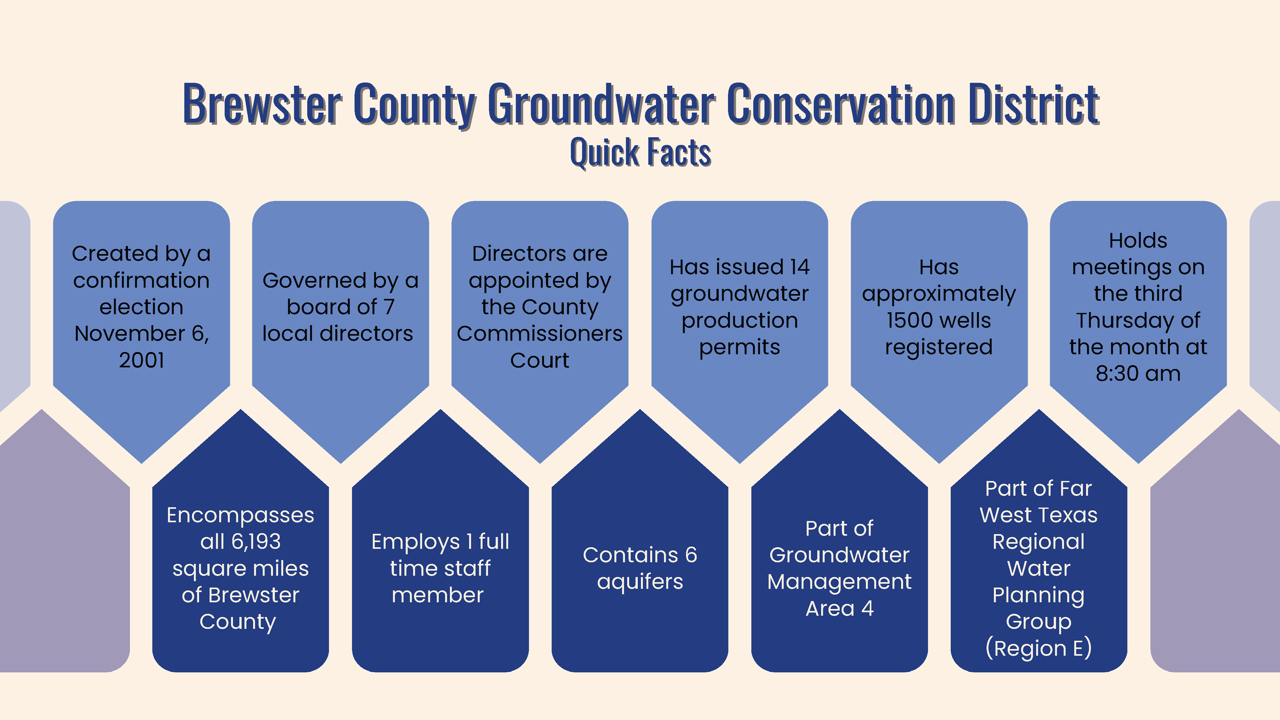
Brewster County Groundwater Conservation District was created by citizens of Brewster County through a confirmation election on November 6, 2001. The District encompasses Brewster County, which covers 6,193 square miles. The county terrain consists of mountains, canyons, plateaus, valleys and rolling plains. Brewster County also lies within the drainage systems of the Rio Grande and Pecos Rivers.
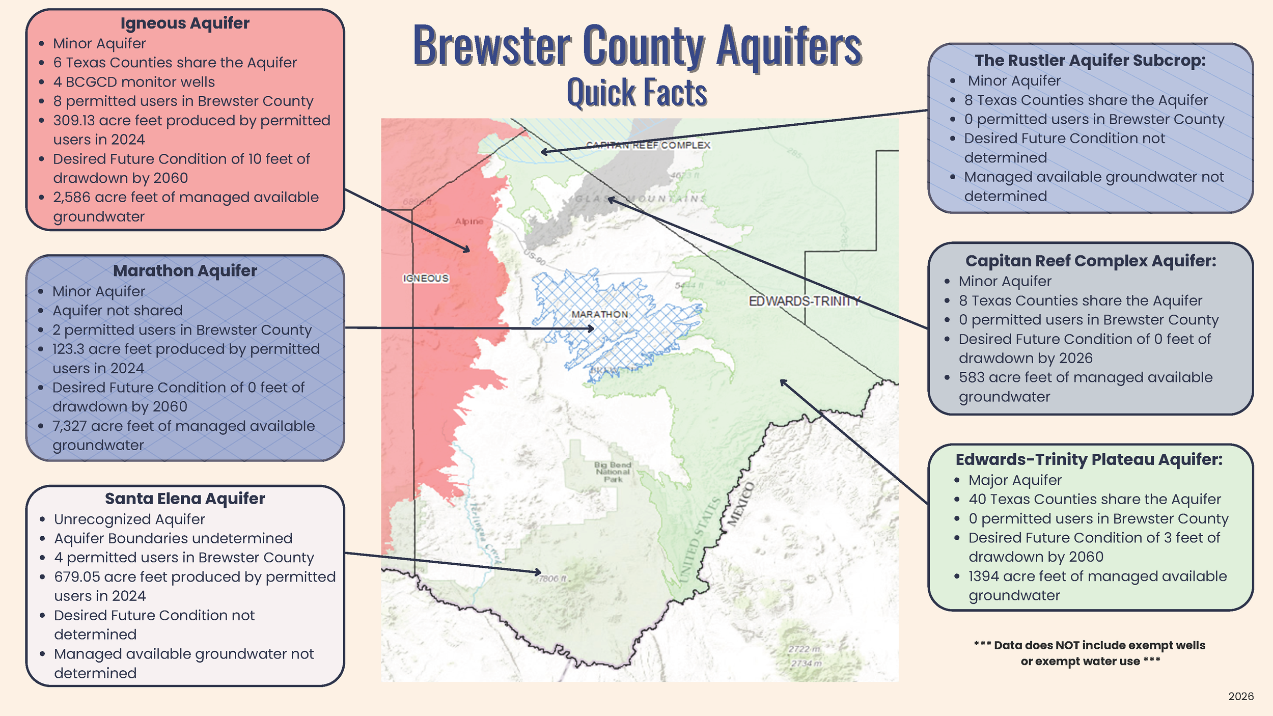
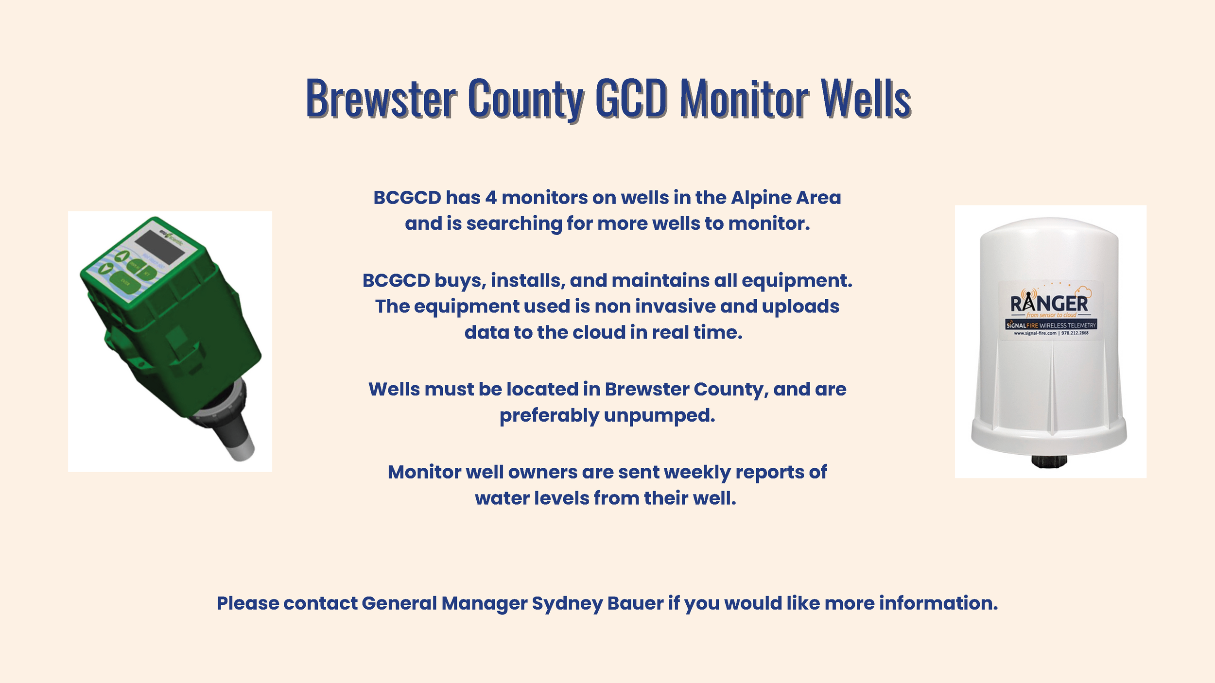
Aquifers. The District manages the production of groundwater from the Marathon, Igneous, Capitan Reef, Edwards-Trinity, and Santa Elena Aquifers within the District in a sustainable manner.
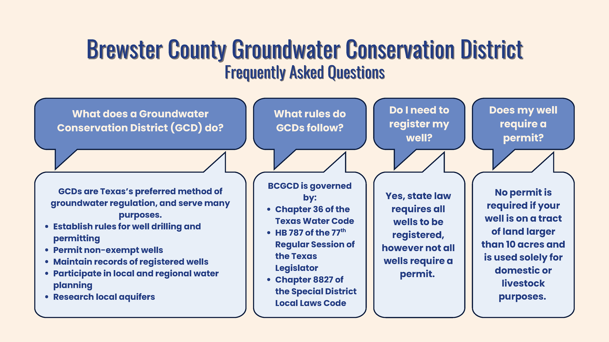
Local Groundwater Use. Municipal water use makes up the majority of water use in Brewster County and in the District. Other water uses include irrigation and livestock. The District requires by rule that all groundwater pumped under Production Permits must be metered. The District has issued fifteen (15) Production Permits, for Irrigation, Industrial and Municipal purposes.
Groundwater Management Area (GMA). GMAs were created to help groundwater conservation districts coordinate planning efforts in their area. Each GMA jointly establishes desired future conditions (DFCs) for their planning area. These DFCs are submitted to the Texas Water Development Board. BCGCD is part of GMA 4, which includes Brewster County GCD, Jeff Davis County GCD, Presidio County UWCD, Culberson County UWCD, and Hudspeth County UWCD No. 1.
Regional Water Planning. There are 16 Regional Water Planning groups in Texas. Every five years, these groups develop regional water plans that later become part of the Texas State Water Plan published by the Texas Water Development Board. BCGCD is part of the Region E Water Planning Group, which includes Brewster, Culberson, El Paso, Hudspeth, Jeff Davis, Presidio and Terrell Counties.